
1
/
av
1
Dahlströms Fine Art
Antique Map - Joseph Roux - Harbour Plan - Port of Ancona in Italy - F5
Antique Map - Joseph Roux - Harbour Plan - Port of Ancona in Italy - F5
Ordinarie pris
$130.00 USD
Ordinarie pris
Försäljningspris
$130.00 USD
Enhetspris
/
per
Skatt ingår.
Det gick inte att ladda hämtningstillgänglighet
Share
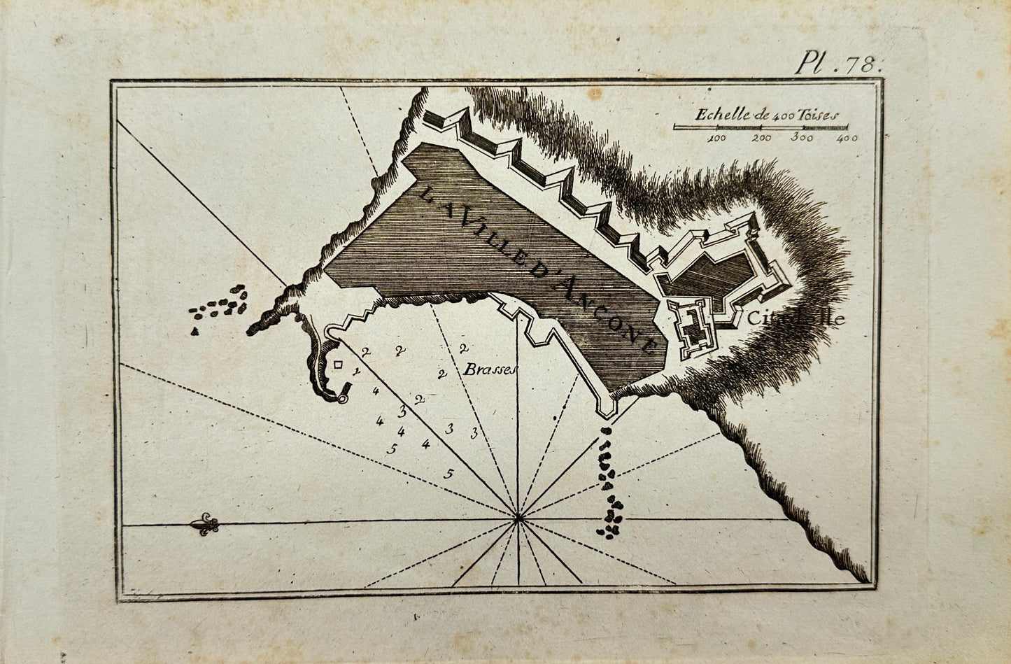
An old 18th century map created in France by the famous engraver and cartographer Joseph Roux in 1764.
This antique map shows the Port of Ancona in Italy. Overlooking the city. The map shows depth measurements and anchorage points.
This chart was used on HMS Victory in 1803 and 1805 and also on HMS Shannon.
Origin: "Recueil des principaux planes des Ports et Rades de la Mer Mediterranee escraits."
Artist
Joseph Roux
Medium
Engraved map
Size
25 cm x 15 cm